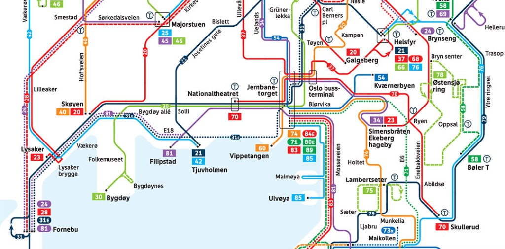
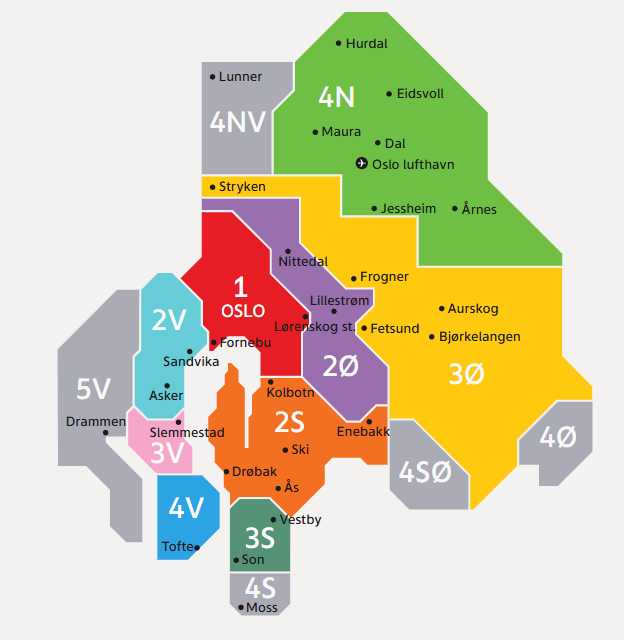
Oslo’s public transport system, Ruter, offers integrated travel via metro (T-bane), trams, buses, ferries, and local trains, mostly operating in Zone 1 (city center). For Oslo Airport (Gardermoen), you need a ticket covering four zones. Oslo has a vast network of transporation modes in the city including the Metro (T-bane), Trams, Buses, Ferries and local trains. Tickets must be purchased in advance via the Ruter app, ticket machines, or kiosks (Narvesen/7-Eleven) to avoid fees. The Oslo Pass provides free travel and museum entry. Download the Ruter app for journey planning and ticket purchases. Tickets must be activated before boarding, especially when using the app. This is a guide for public transporation in Oslo.
Key Public Transporation Modes
Metro (T-bane): Five color-coded lines, all passing through the city center (Nationaltheatret and Jernbanetorget/Oslo S).
Trams: Six lines covering the city, with frequent services stopping at major points.
Buses: Extensive network serving the city and suburban areas.
Ferries: Operate from Aker Brygge to nearby islands and fjord sites.
Local Trains: Useful for reaching specific areas faster than buses.
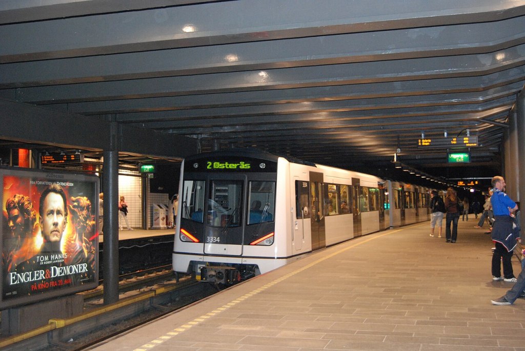
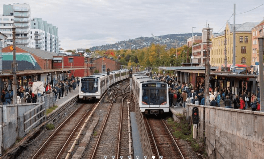
Metro (T-Bane)
The Oslo Metro (known locally as the T-bane) is the rapid transit system serving Oslo and the neighboring municipality of Bærum.
Key System Facts
Network: The system consists of 5 lines (numbered 1–5) serving 101 stations.
The Common Tunnel: All five lines share a central underground section between Majorstuen and Tøyen, meaning trains arrive every few minutes in the city center.
Operating Hours: Trains generally run from 5:00 AM to midnight, with frequencies every 10–15 minutes.
The Ring Line: Line 5 forms a loop (the “Ringen”) that connects the city center with northern boroughs like Nydalen and Storo.
Major Lines & Destinations
Line | Route | Key Destinations
| Line | Route | Key Destinations |
| Line 1 (Light Blue) | Frognerseteren ↔ Bergkrystallen | Holmenkollen Ski Jump, Nordmarka forest |
| Line 2 (Orange) | Østerås ↔ Ellingsrudåsen | Munch Museum (Tøyen), Bærum suburbs |
| Line 3 (Green) | Kolsås ↔ Mortensrud | Ullevaal Stadion |
| Line 4 (Dark Blue) | Vestli ↔ Bergkrystallen | Nydalen business district |
| Line 5 (Yellow) | Sognsvann ↔ Vestli | Ring Line, University of Oslo (Blindern) |
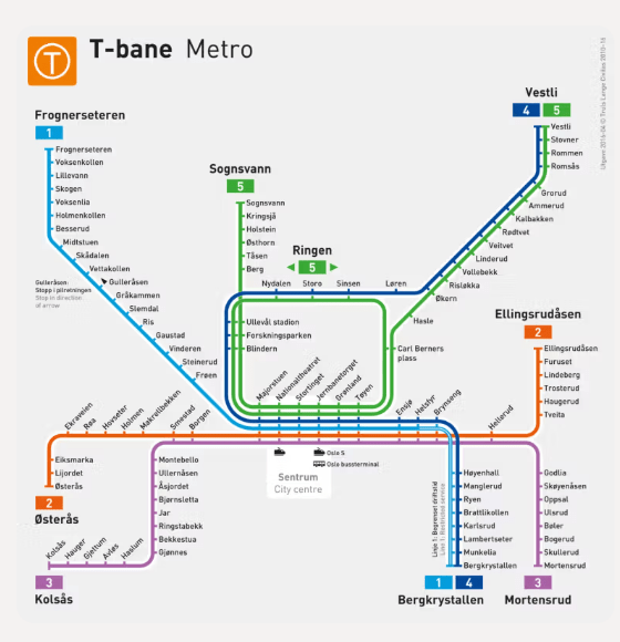
Current Status: Major upgrades are planned for 2025, which may result in temporary station closures (such as Majorstuen) and replacement bus services.
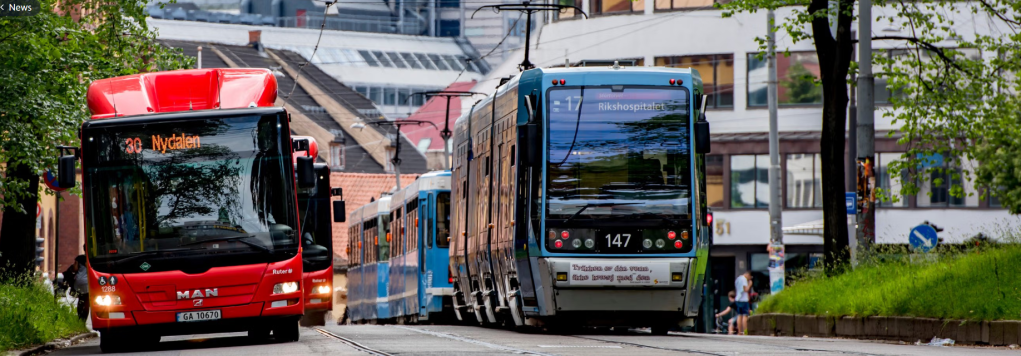
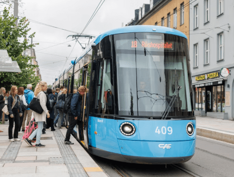
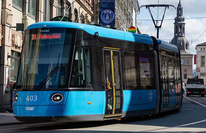
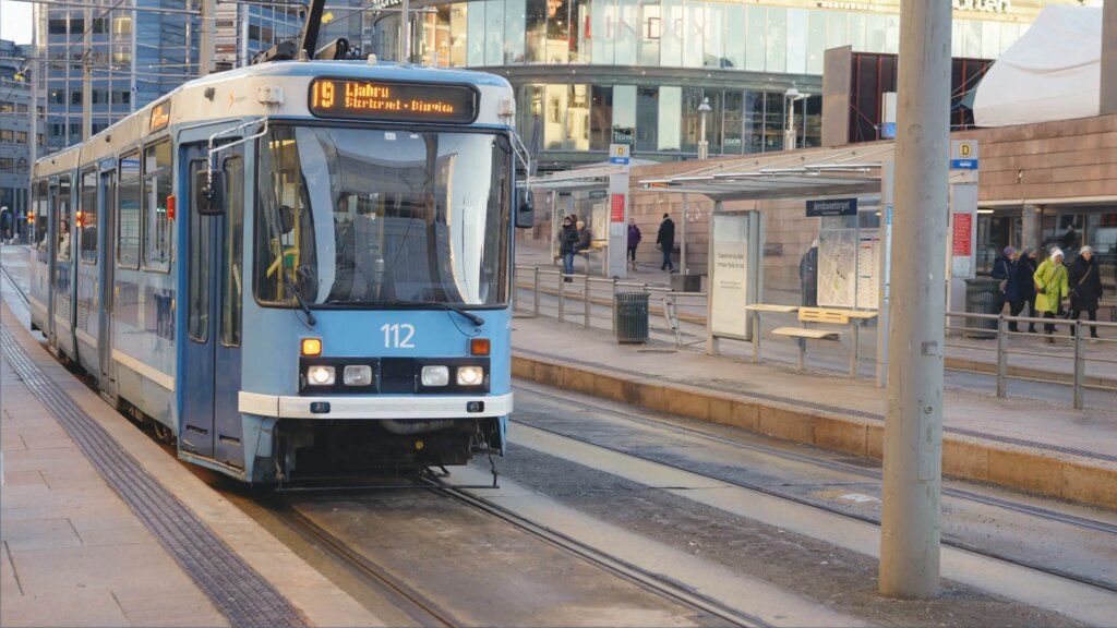
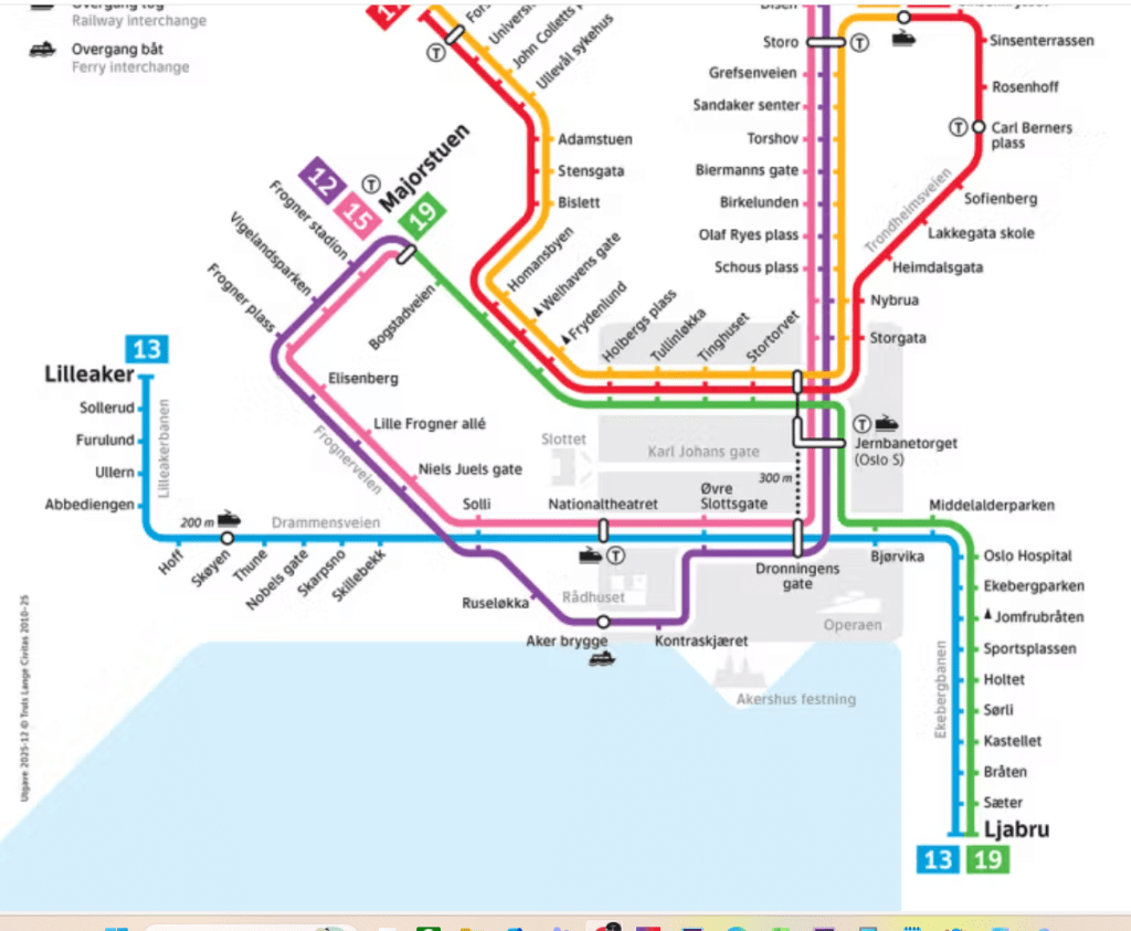
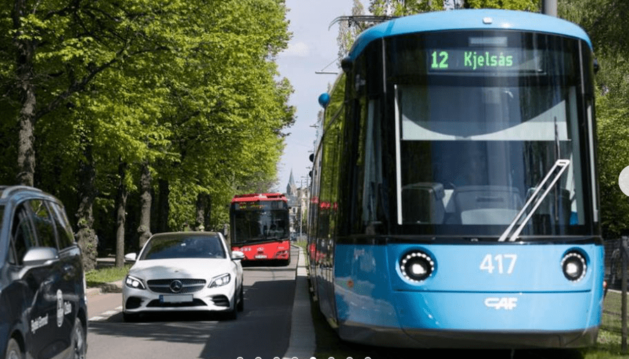
Trams (Trikken)
The Oslo Tram is a scenic and efficient way to navigate the city center and its inner suburbs.
System Overview
Lines: There are 6 lines (11, 12, 13, 17, 18, and 19) serving 99 stops.
Operating Hours: Trams typically run from 5:00 AM to midnight.
Frequency: Most lines run every 10 minutes during the day and every 20 minutes in the late evening and on weekends.
The “Rolling Sidewalk”: In central areas where multiple lines overlap, trams arrive as frequently as every 5 minutes.
Fleet: As of 2026, the network primarily uses modern SL18 low-floor trams, which are quieter and more accessible than previous models.
Notable Routes for Sightseeing
Line | Scenic Highlights & Designations
Line 12- One of the most popular for tourists; stops at Vigeland Sculpture Park, Aker Brygge, City Hall, and Akershus Fortress.
Line 13- Passes through the trendy Grünerløkka district, known for its vibrant street life, shops, and cafes.
Line 19- Travels from Majorstuen through the city center to the Ekeberg Sculpture Park, offering panoramic views of the Oslo Fjord.
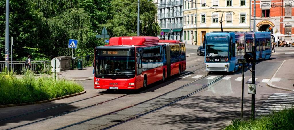
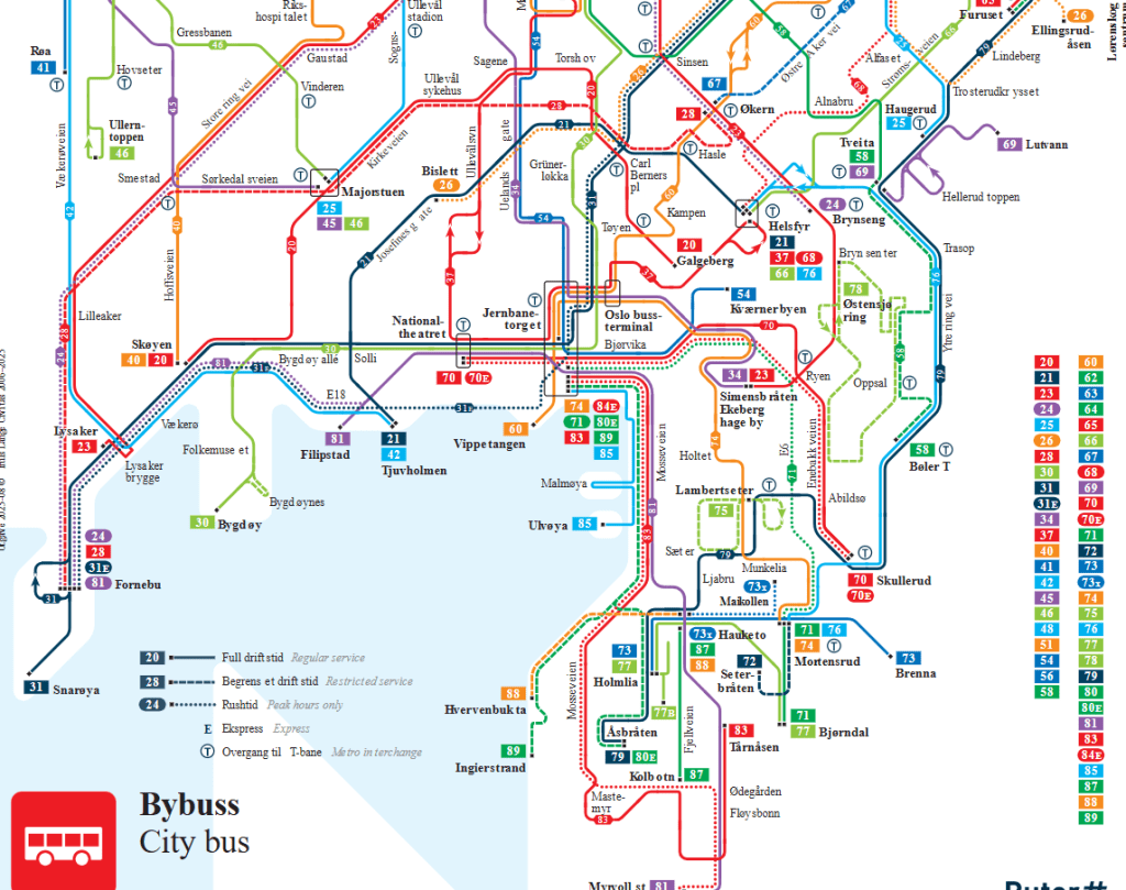
Buses
Oslo’s bus network is an extensive system that fills the gaps between the Metro and tram lines, reaching nearly every corner of the city and its surrounding suburbs.
Key Bus Types
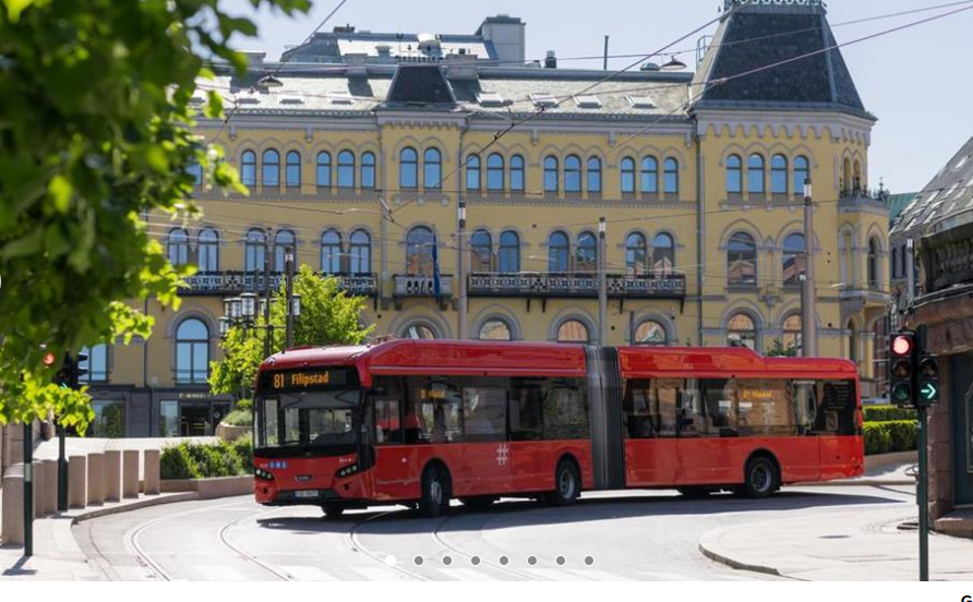
Red City Buses: These are local buses that crisscross the city center. You can board using any door on these buses.
Green Regional Buses: These travel further into the surrounding Akershus region. On these, you must enter at the front and show or scan your ticket for the driver.
Night Buses: Regular service typically ends around midnight, but special night buses run on weekends to provide 24-hour connectivity.
Popular Routes for Visitors
Bus 30 (Bygdøy): The most essential route for tourists. It runs from the city center to the Bygdøy peninsula, home to the Fram Museum, the Kon-Tiki Museum, and the Norwegian Museum of Cultural History.
Bus 31 (Fornebu): One of Norway’s busiest routes, providing high-frequency service (up to 50 times per hour during peaks) through the city center.
Buses 32 & 81: These provide easy access to the Barcode district, the Oslo Opera House, and the Munch Museum.
Major Hubs
Oslo Bussterminal: Located next to Oslo Central Station, this is the primary hub for green regional buses and long-distance coaches.
Jernbanetorget: The massive square outside the central station serves as a major transfer point for almost all city bus lines, trams, and the Metro.
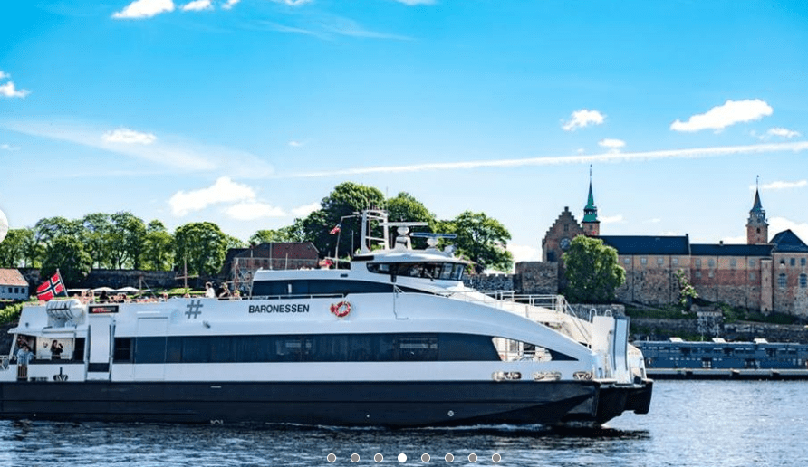
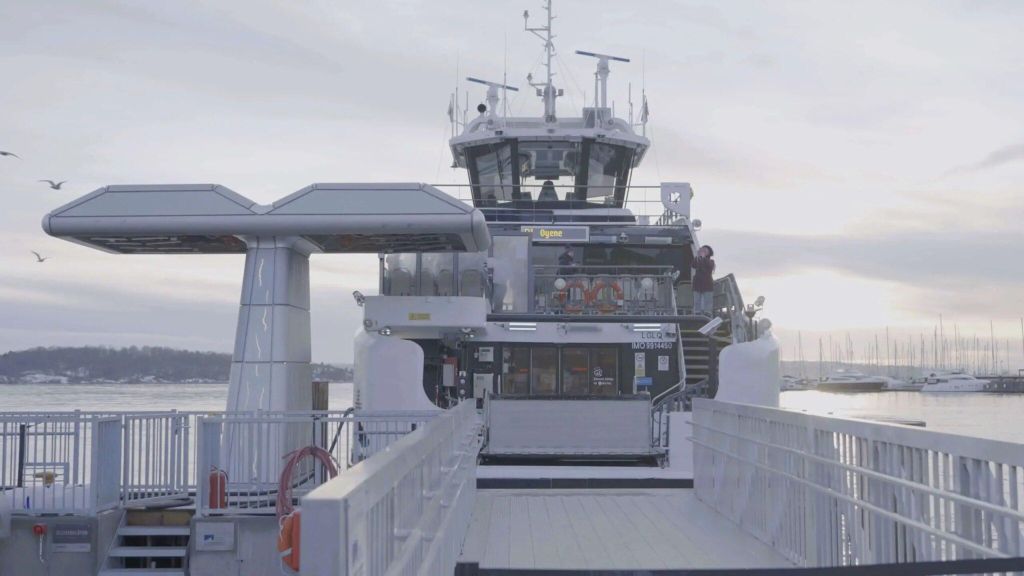
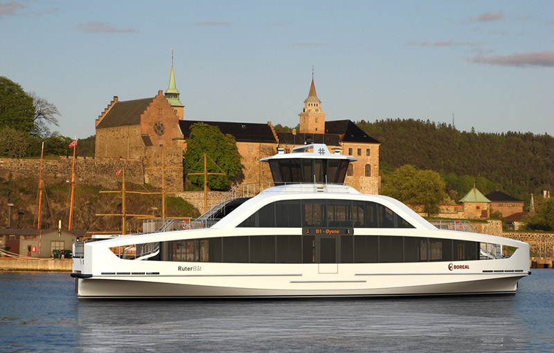
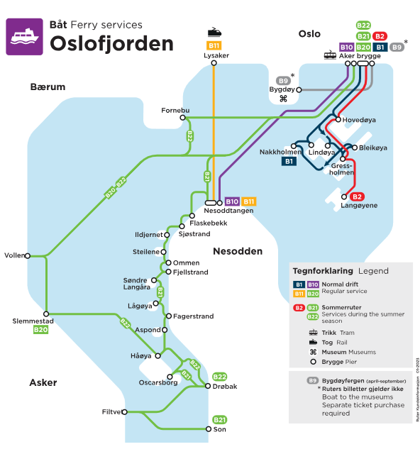
Ferries
In Oslo, the ferries are a scenic extension of the public transport system. Because the city is built around the Oslo Fjord, these boats are often the most direct (and beautiful) way to reach the nearby islands and museums.
Types of Ferries
| Service Type | Key Routes | Purpose |
| Ruter Public Ferries | B1, B2 (Islands), B10 (Nesodden) | Commuting and island hopping. Uses standard city tickets. |
| Bygdøy Ferry | Line 91 (City Hall ↔ Bygdøy) | Direct access to the Fram and Kon-Tiki museums. |
| International Ferries | Oslo ↔ Copenhagen / Kiel / Frederikshavn | Large cruise-style overnight ships. |
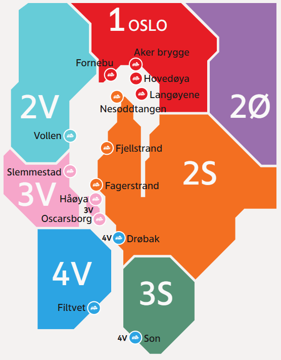
Ruter Island Ferries (Lines B1, B2)
These departures leave from Aker Brygge (near City Hall). Since they are part of the Ruter network, your standard Metro or Tram ticket is valid here.
Hovedøya: The closest island, famous for its Cistercian monastery ruins and swimming beaches.
Lindøya & Nakholmen: Known for their iconic, colorful tiny wooden summer cabins.
Gressholmen: Great for hiking and spotting local wildlife.
The Bygdøy Museum Ferry (Line 91)
This ferry runs from Pier 3 behind City Hall directly to the Museum Peninsula.
Note: While this is a “public” service, it is operated privately. Ruter tickets are NOT valid here unless you have an Oslo Pass.
Tickets: You can buy them at the pier or on the boat. It is significantly faster than taking the #30 bus during rush hour.
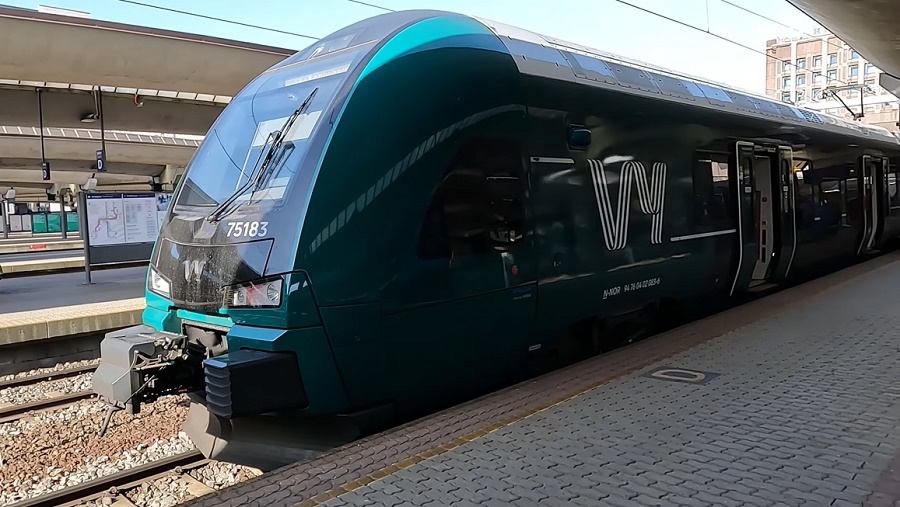
Local Trains
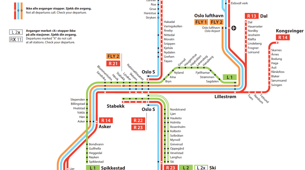
The local trains (historically called NSB, now operated by Vy) function as the “S-train” equivalent, connecting the city center to the outer suburbs and nearby towns like Drammen, Lillestrøm, and Ski.
The Hub: Oslo Central Station (Oslo S)
Almost every local train passes through the Oslotunnelen, a central tunnel with stops at Oslo S, Nationaltheatret, and Skøyen. This makes them a very fast alternative to the Metro if you are traveling between these major city points.
Unified Ticketing (Ruter)
The most important thing to know is that Ruter tickets are valid on Vy local trains within the city limits (Zone 1).
Zone 1 Coverage: If your journey starts and ends within Oslo (e.g., Oslo S to Holmlia or Grorud), you can use the Ruter app or a standard Ruter travel card.
Beyond Oslo: If you travel to places like the Tusenfryd Amusement Park (Vinterbro) or Lillestrøm, you will need a ticket covering Zones 2 or 3.
Popular Routes for Travelers
L1 (Spikkestad – Lillestrøm): A “stop-at-every-station” line that is great for reaching local neighborhoods.
L2 (Ski – Stabekk): Connects the southeastern suburbs to the city.
R12, R13, R14: Faster “Regional” trains that stop at fewer stations but are still accessible with a Ruter ticket within the valid zones.
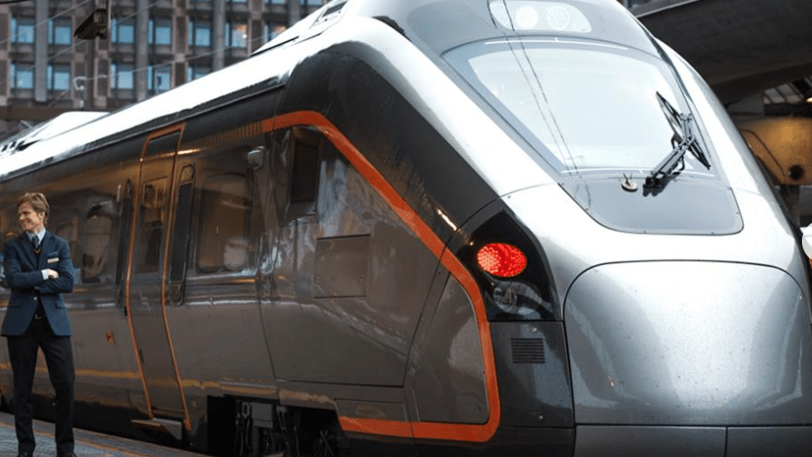
Important: The Airport Train (Flytoget)
Do not confuse the local Vy trains with the Flytoget Airport Express.
Flytoget is a premium, high-speed service to Oslo Airport (OSL)
You can take a Vy local train (Lines R12, RE10, or RE11) to the airport for about half the price of Flytoget, and it only takes a few minutes longer.
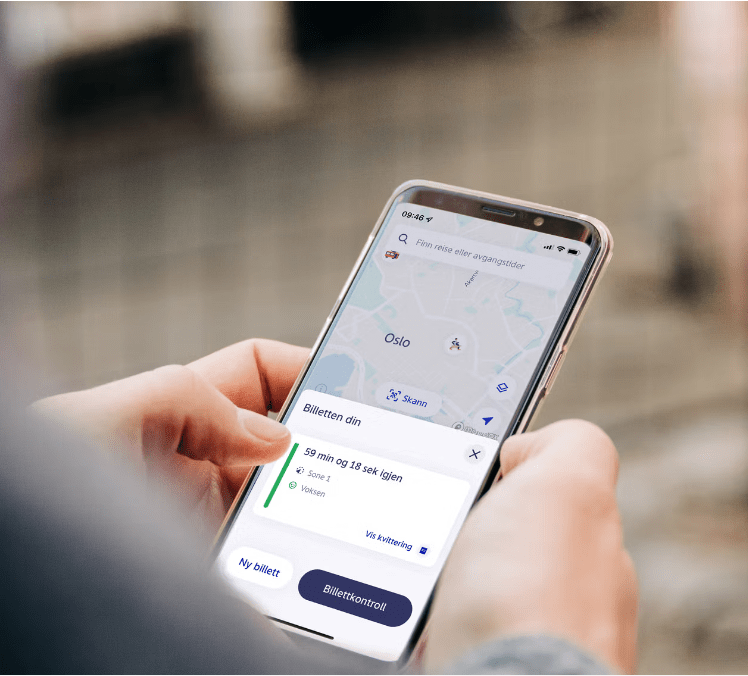
Ruter App
The Ruter app is the “must-have” tool for getting around Oslo. It handles everything from route planning to ticket purchases for the Metro, trams, buses, ferries, and local trains.
Core Features
Trip Planner: Enter your destination, and it gives you door-to-door directions using all modes of transport. It even shows real-time GPS locations of buses and trams.
All-in-One Ticket: One ticket works for Ruter (city transit) and Vy (local trains) within the zones you’ve purchased.
Ticket Types: You can buy single tickets (valid for 60 mins), 24-hour, 7-day, 30-day, or 365-day passes directly in the app.
Zone Map: It automatically calculates how many zones you are crossing (most tourist attractions are in Zone 1)
Why Use the App?
Cheaper Fares: Buying in the app is significantly cheaper than buying a ticket with cash from a bus driver.
Contactless: No need for paper tickets or physical travel cards. Just show the QR code in the app if an inspector asks.
City Bike Integration: You can now see the availability of Oslo City Bikes and even unlock them directly through the Ruter app.
Activate Before Boarding: You must have a valid ticket before you step onto the vehicle. The app shows a countdown and a moving animation to prove it’s active.
“Reis”: Ruter recently introduced a smart discount called Reis. The more single tickets you buy in a 30-day period, the bigger the discount you get on your next purchase
You need data to buy a ticket, but once purchased, the ticket remains available offline for inspection.
Day Passes
The Ruter 24-hour ticket (often called a “day pass”) is the most cost-effective option if you plan to make more than three trips within a 24-hour window. It provides unlimited travel on all buses, trams, metro lines, ferries, and local trains within your selected zones.

2026 Ticket Prices (Zone 1)
As of early 2026, most visitors only need Zone 1, which covers the entire city of Oslo and all metro stops.
Passenger Category | 24 Hour Ticket (1 Zone) | 7 Day Ticket (1 Zone)
Adult – > 127 NOK – > 352 NOK
Child – > 64 NOK – > 176 NOK
Senior – > 64 NOK – > 176 NOK
How to Buy
Ruter App: The easiest method. Buy and activate your ticket instantly on your phone.
Kiosks: You can buy physical tickets at Narvesen, 7-Eleven, Mix, and Deli de Luca.
Ticket Machines: Available at major stations like Jernbanetorget (Oslo Central) and some metro stops.
Important: You cannot buy day passes or 7-day tickets on board buses or trams; they must be purchased before boarding.
Key Rules & Tips
Activation: The 24-hour period begins the moment you activate the ticket in the app or scan your physical card for the first time.
Group Travel: You can buy 24-hour tickets for multiple people on a single phone using the Ruter app, but you must all travel together.
Airport Exception: A Zone 1 day pass does not cover the trip to Oslo Airport (OSL), which requires a 4-zone ticket (129 NOK extra).
May 2026 Price Drop: Be aware that while 30-day passes will see a major price reduction on May 3, 2026, shorter-term day and week passes are expected to maintain current rates.
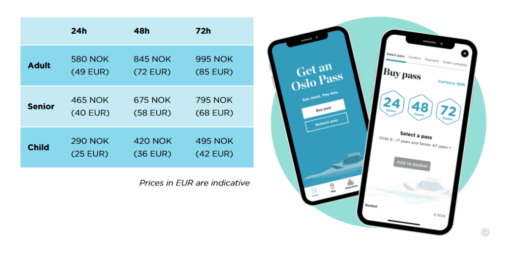
Oslo Pass
The Oslo Pass is the official city card designed for tourists, combining unlimited public transport with free entry to over 30 museums and attractions. It is available for 24, 48, or 72 hours and is managed via the Oslo Pass app.
Key Benefits
Free Admission: Includes entry to top sites like the MUNCH Museum, Nobel Peace Center, Fram Museum, and Akershus Castle.
Unlimited Transport: Covers all Ruter buses, trams, metro lines, and public ferries in Zones 1, 2, 3, 4V, and 4N.
Airport Travel: Includes travel to and from Oslo Airport (Gardermoen) via Vy local trains (Note: It does not cover the Flytoget Express).
Exclusive Access: Includes the Bygdøy Ferry (Line 91), which otherwise does not accept standard Ruter tickets.
Discounts: Savings on sightseeing tours, Oslo City Bike rentals, and 20% off at select restaurants.

How to Buy and Use
Digital: Purchase directly in the Oslo Pass app. You can buy passes in advance and they remain valid for one year until you swipe to activate them upon arrival.
Physical: Available at the Oslo Visitor Centre at the Central Station if you prefer a physical card or need a student discount (20% off for students under 30 with valid ID).
Validation: Show your active app QR code to museum staff or transport ticket inspectors when requested.
Most museums in Oslo close by 4:00 PM or 5:00 PM. To get the best value, activate your pass in the morning to maximize your museum-hopping time.
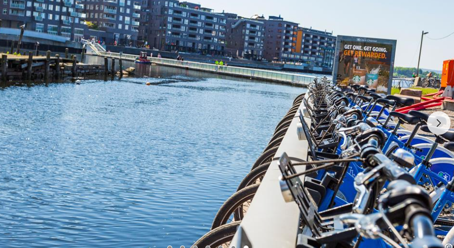
Cycling & City Bikes
Oslo is one of Europe’s easiest capitals to bike in — compact, scenic, and filled with dedicated bike lanes — and the Oslo City Bike system (Oslo Bysykkel) makes it incredibly simple to ride on demand. Below is a complete, structured guide to both biking and City Biking in Oslo, grounded in the latest information.

Biking in Oslo: The Complete Guide
Oslo blends urban cycling, fjordside cruising, and forest gravel riding in a way few capitals can match. The city has over 230 km of cycling infrastructure, and the network grows every year.
Why Oslo Is So Bike‑Friendly
Compact city — short distances between neighborhoods and attractions.
Dedicated bike lanes across major streets and corridors.
Bikeable climate — summers rarely exceed 25°C.
Easy access to nature — forests, lakes, and fjord paths start right at the city edge.
Oslo City Bike (Oslo Bysykkel)
The city’s official bike‑share system — perfect for short trips, sightseeing, and spontaneous rides.
How It Works
Unlock bikes via the Oslo City Bike app.
200+ stations across central Oslo.
Ride up to 1 hour per session, then dock and take another bike.
Designed for quick, flexible city mobility — not long-distance rides.

Pricing & Passes
72‑hour pass
30‑day pass
Annual pass
Pay‑per‑ride option
(All confirmed by Visit Norway’s City Bike overview.)
Best Uses
Hopping between neighborhoods (Grünerløkka → Frogner → Aker Brygge)
Fjord promenade rides
Quick errands or short sightseeing loops

Top Bike Routes in Oslo
Based on expert recommendations and official tourism sources.
1. Oslo Harbour Promenade
Flat, scenic, perfect for beginners.
Runs from Sørenga → Opera House → Aker Brygge → Tjuvholmen.
One of Visit Norway’s top recommended routes.
2. Bygdøy Peninsula Loop
Museums + beaches + quiet roads.
Great for a half‑day ride.
Officially listed as a top‑3 route.
3. Maridalsvannet Lake Circuit
Nature-heavy, peaceful, and close to the city.
Ideal for a longer, relaxing ride.
Also a top‑3 recommended route.
4. Nordmarka Forest Gravel (Bikepacking Capital)
400+ km of car‑free forest roads.
Perfect for gravel, adventure, and long rides.
Oslo is considered a European gravel hotspot.

Bike Rentals & Tours
If you want something beyond City Bikes:
Viking Biking & Hiking
Guided tours + rentals.
Popular with visitors.
Rouleur Oslo
High-end rentals, café, bar, and workshop.
Strong gravel and road cycling culture.
FARA Cycling
Premium road/gravel bikes for rent or purchase.
Rules, Safety & Local Etiquette
Oslo is safe for biking, but there are a few must‑knows:
Safety Basics
Same rules as cars: keep right, obey traffic lights.
Wear a helmet (strongly recommended).
Use lights at night — police do occasional checks.
Avoid tram tracks — the #1 hazard for new riders.
Sidewalks
Avoid cycling fast on sidewalks; pedestrians don’t expect it.
Weather
Summer: ideal.
Winter: locals use studded tires; tourists often switch to transit.
Bringing Bikes on Public Transport
Allowed on metro, trains, and many ferries.
Useful for reaching the forest edge (Nordmarka).
Subway is the most practical for space.
Why Use Oslo’s Public Transporation
Thanks to Oslo’s excellent public transportation system Ruter, it is easy to travel around the city. Distances between attractions are often quite short, so you can explore a lot of the city by walking or biking. All public transport in Oslo and the surrounding boroughs are included in one ticketing system. That includes city and regional buses, trams, undergrounds, local trains and ferries. The ferries to Bygdøy are not included.
One of the easiest ways to get and manage tickets for public transport is using the mobile app Ruter. With the Oslo Pass, you can travel for free within zone 1. Oslo is a great city for bicycle trips, with a compact city centre and short distances to major attractions.

Leave a comment