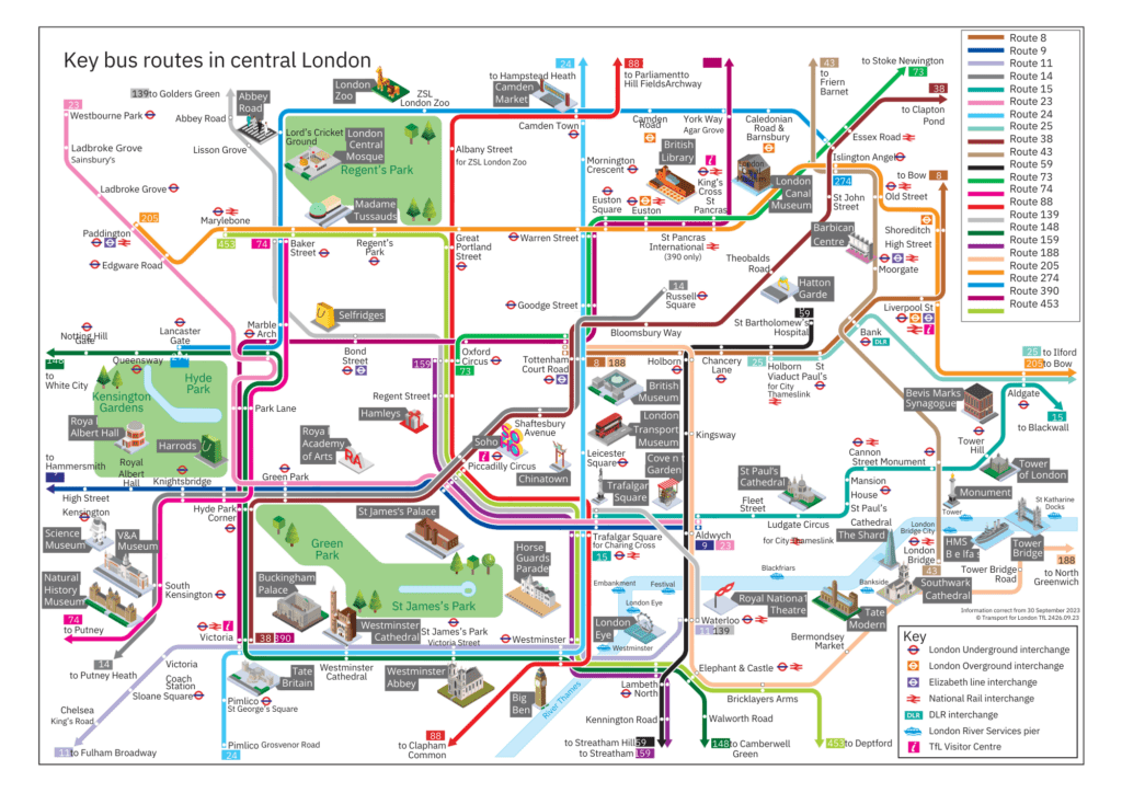
London has one of the world’s most extensive, multimodal transit networks—Tube, Elizabeth line, buses, Overground, DLR, trams, river buses, and cycling—integrated under TfL’s unified fare system. This guide gives you a system-level overview, practical navigation tips, and a framework for mapping London’s transit identity. Avoid changing at Green Park during peak hours—crowded and slow. Walking is often faster between close stations (e.g., Leicester Square ↔ Covent Garden). Use TfL Go app for live status, closures, and accessibility info. Mind the Zones: Most tourist travel is Zones 1–2. Buses don’t accept cash—use contactless/Oyster only. Elizabeth line is fast but not always direct—sometimes Tube lines offer better station placement.
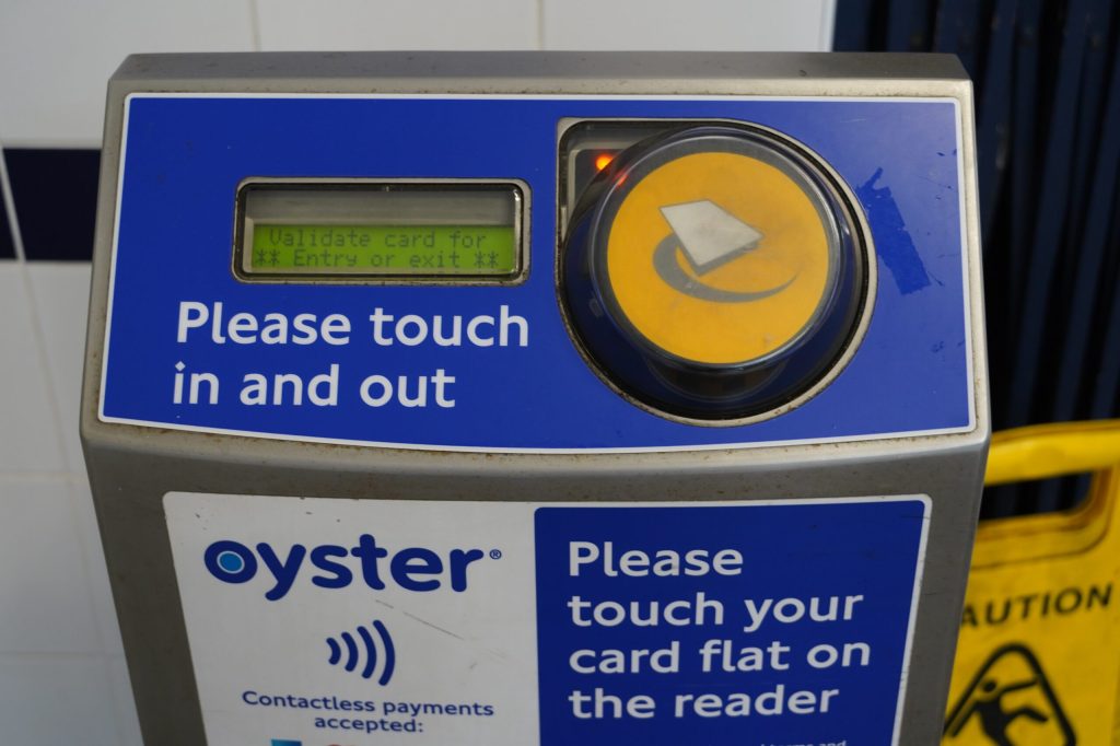
Contactless payment is Recommended; just Tap in/out with bank card or phone. Daily/weekly fare caps apply automatically and is the cheapest and simplest option. Oyster Card is a prepaid smartcard, have the same fares as contactless, but require a £7 refundable deposit. Travelcards are another option; Unlimited travel for 1 day, 7 days, or longer. It’s only if staying in outer zones or making many trips. Stations have clear signage and CCTV; Many Elizabeth line and newer Tube stations offer step‑free access. Night Tube and night buses provide 24/7 mobility on weekends.
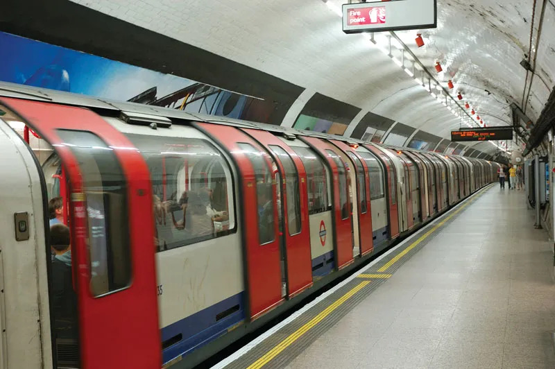
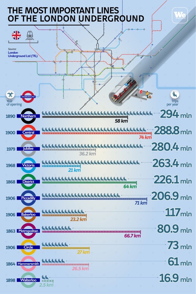
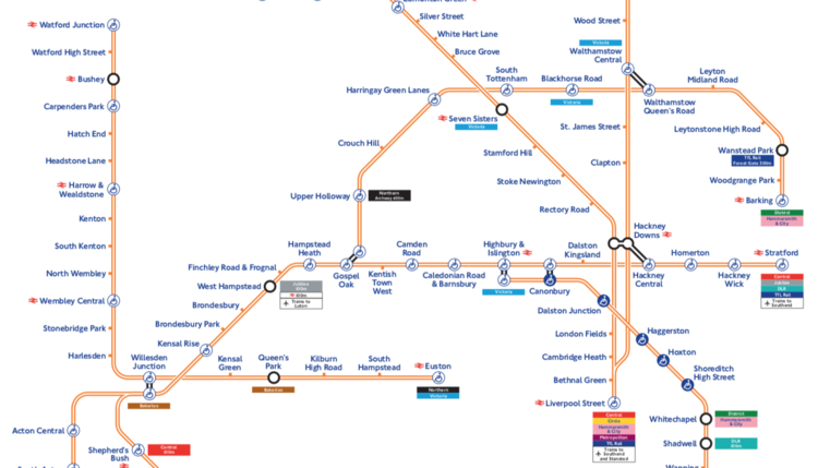
London Underground (Tube)
London’s backbone rail system, covering most of Zones 1–6.
11 lines, 272 stations
Fastest way across central London
Frequent service: every 2–5 minutes in central zones
Night Tube on select lines (Fri–Sat)
Best for: Cross‑city travel, predictable journey times, avoiding traffic.
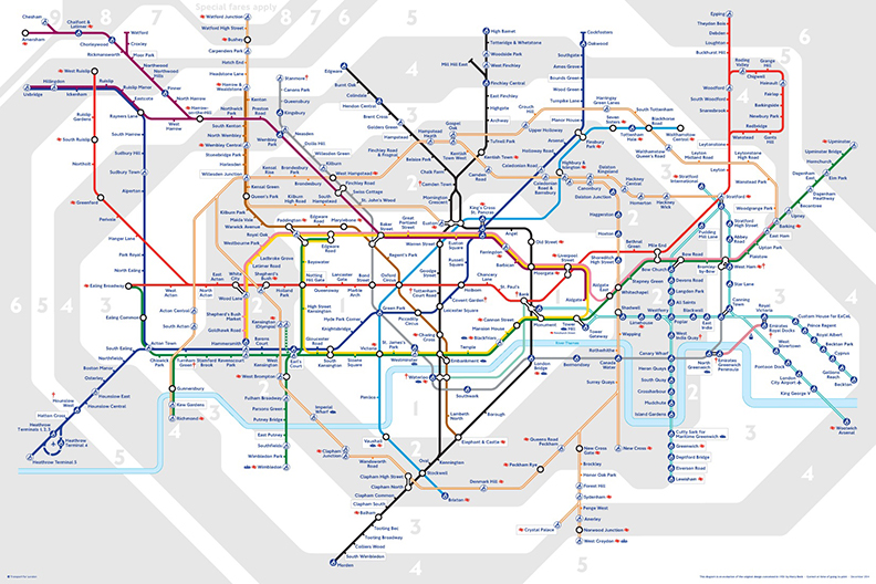
The 11 Tube Lines
| Line | Color | Identity & Use Case |
| Bakerloo | Brown | Old-school rolling stock; NW–SE spine. |
| Central | Red | Fast east–west trunk; very busy. |
| Circle | Yellow | Loops central London; good for museums. |
| District | Green | West London suburbs ↔ City; versatile. |
| Hammersmith & City | Pink | Parallel to Circle; quieter alternative. |
| Jubilee | Grey | Modern, fast; Canary Wharf access. |
| Metropolitan | Magenta | Long-distance suburban express. |
| Northern | Black | Long-distance suburban express. |
| Piccadily | Dark Blue | Heathrow access; deep-level. |
| Victoria | Light Blue | High-frequency, high-speed connector. |
| Waterloo & City | Turquoise | Two-stop shuttle (Waterloo ↔ Bank) |
Major interchanges: King’s Cross–St Pancras, Paddington, Liverpool Street, Baker Street, Oxford Circus
Key Stations & Their Roles
| Station | Lines | Identity |
| Paddington | Bakerloo, Circle, District, H&C | Gateway node; Heathrow Express + Elizabeth line integration. |
| King’s Cross – St Pancras | 6 Lines | London’s intercity brainstem; Eurostar. |
| Oxford Circus | Bakerloo, Central, Victoria | Central interchange vortex. |
| Bank/Monument | Central, Northern, DLR, Circle, District | Financial district labyrinth. |
| Waterloo | Bakerloo, Jubilee, Northern, W&C | South Bank cultural spine. |
Key Transit Hubs (for your mapping overlays)
| Hub | Lines/Services | Identity & Narritive |
| Paddington | Elizabeth line, Heathrow Express, Bakerloo, Circle, District, Hammersmith & City | Gateway node; Victorian engineering meets modern reinvention. |
| King’s Cross–St Pancras | 6 Tube lines + Eurostar | London’s intercity brainstem; regeneration success story. |
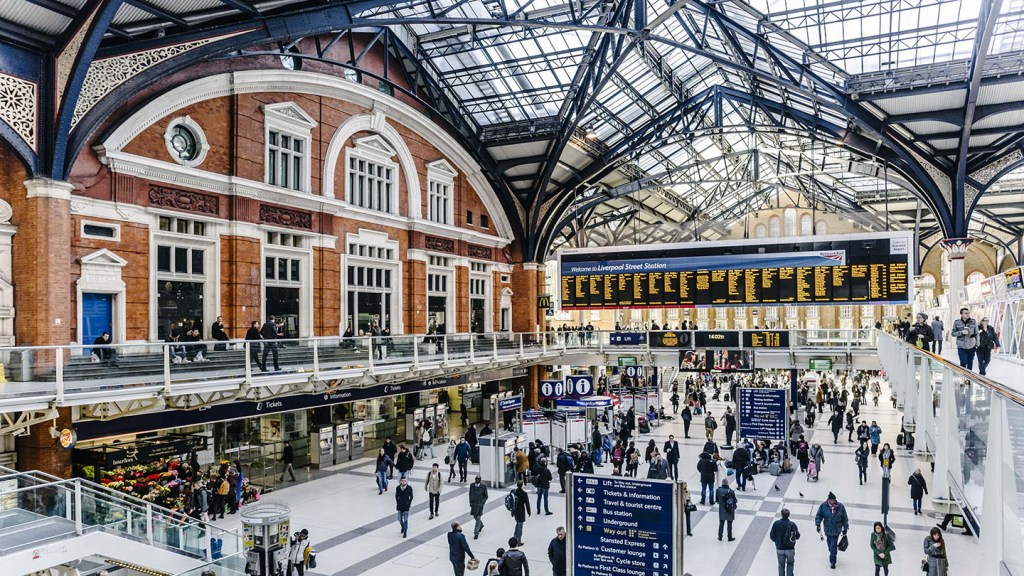
| Liverpool Street | Elizabeth line, Overground, Central, Circle, H&C, Metropolitan | Financial district anchor; east‑west pivot. |
| Waterloo | Bakerloo, Jubilee, Northern, Waterloo & City + National Rail | South Bank cultural spine. |
| London Bridge | Jubilee, Northern + National Rail | Shard district; south‑north commuter funnel. |
Elizabeth line
London’s newest, high‑capacity, high‑speed rail corridor.
Connects Heathrow ↔ Paddington ↔ Central London ↔ Canary Wharf ↔ Shenfield/Reading
Modern trains, level boarding, wide corridors
Extremely fast: Heathrow–Paddington in ~28 minutes
Integrated fares with Tube
Best for: Airport access, east–west travel, comfort, reliability.
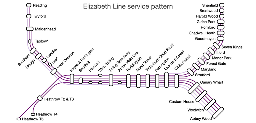
Western Termini
Reading
Heathrow Terminals 2&3, 4, 5
Central London Core
Paddington
Bond Street
Tottenham Court Road
Farringdon
Liverpool Street
Whitechapel
(All part of the high‑speed central tunnel section)
Eastern Termini
Shenfield
Abbey Wood
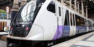
The Elizabeth line is London’s newest, high‑speed, high‑capacity rail corridor, running from Heathrow and Reading in the west through central London to Shenfield and Abbey Wood in the east. It offers fast airport access, modern trains, and full step‑free access across all stations. A major east–west rail line operated under TfL, opened in May 2022. It Runs 117 km (73 miles) with 41 stations and uses modern Class 345 trains with level boarding and wide walk‑through interiors.
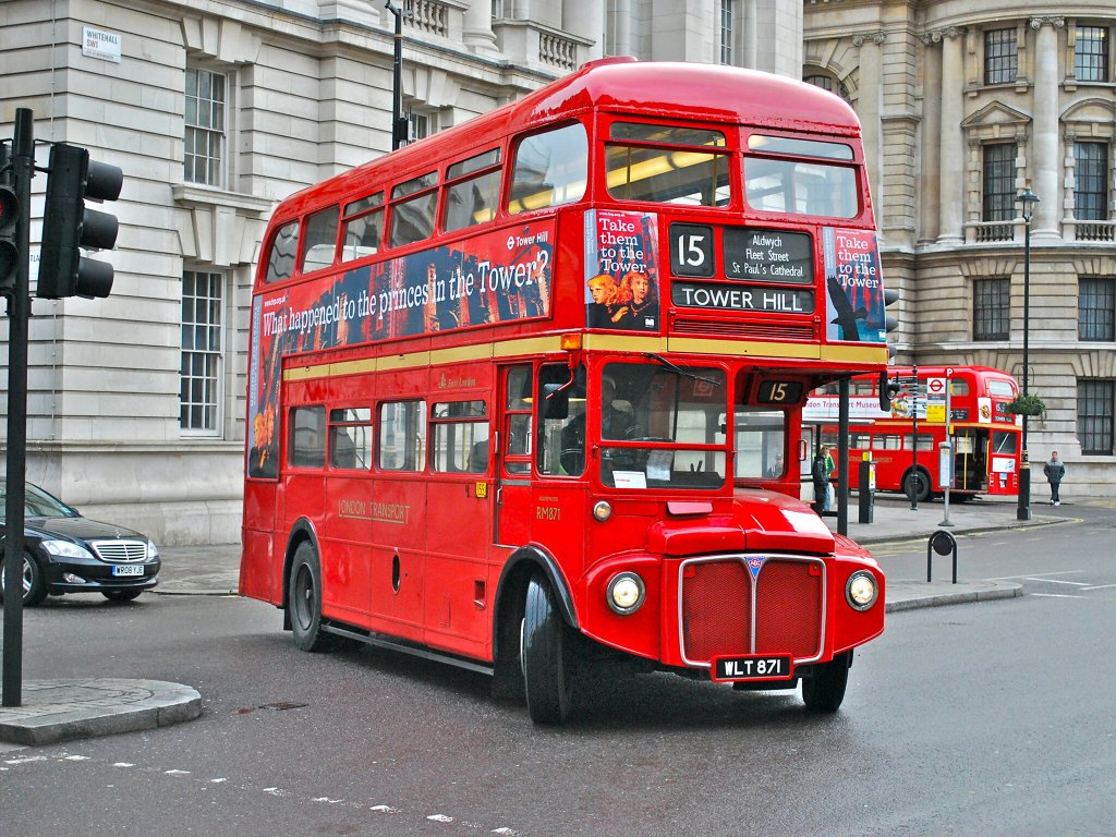
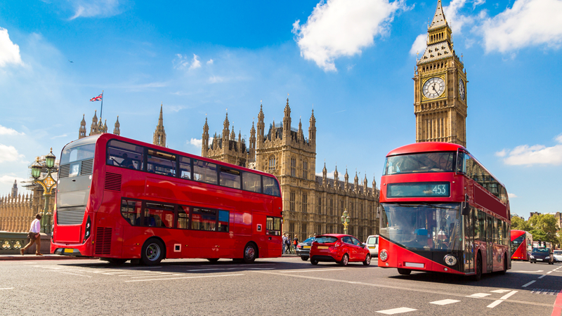
London Buses
London’s red buses form one of the world’s largest, cheapest, and most extensive surface‑transport networks. They are fully cashless, run 24/7 on many routes, and are regulated by Transport for London (TfL), which manages fares, operators, maps, and live arrival tools. Iconic red double‑deckers with panoramic upper‑deck views; Hundreds of routes and thousands of stops, covering every part of Greater London.
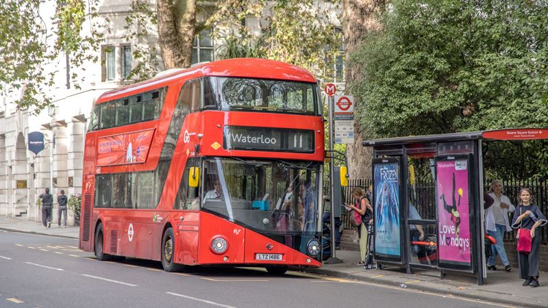
Citywide coverage, 24/7, often faster than the Tube for short hops.
Flat fare across all zones
Extensive night bus network
Great for surface‑level city exploration
Best for: Short distances, late nights, scenic routes.
Best Scenic Bus Routes
(From VisitLondon & London Toolkit)
- Route 11 — St Paul’s → Trafalgar Square → Westminster
- Route 24 — Camden → Trafalgar Square → Westminster
- Route 9 — Kensington → Hyde Park → Piccadilly
Upper deck = free sightseeing tour.
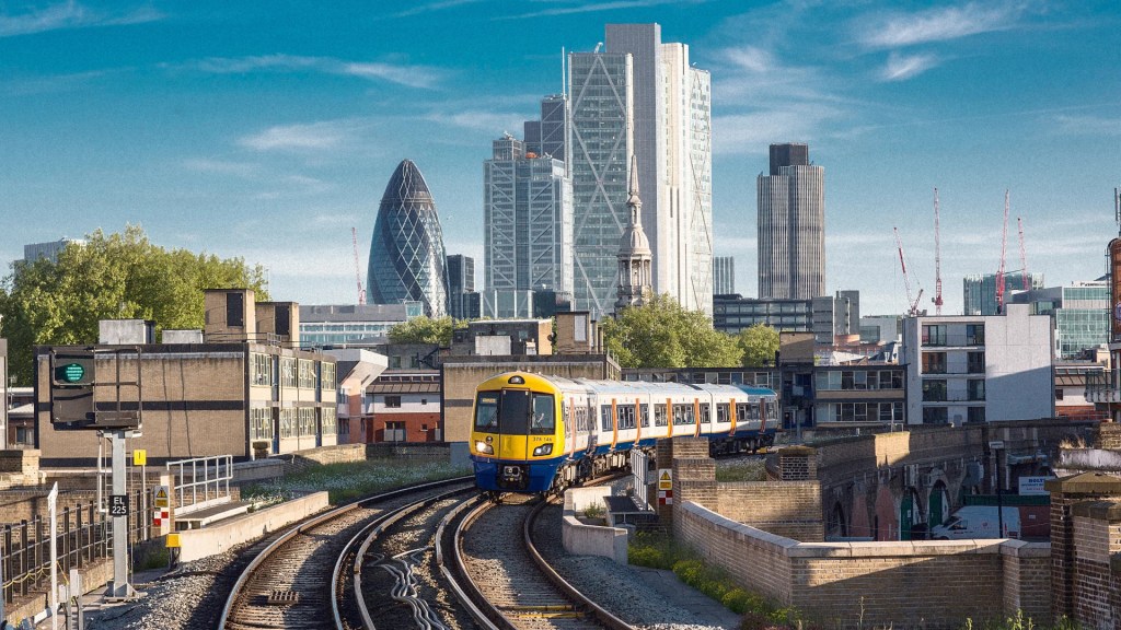
London Overground
The London Overground is a 6‑line suburban rail network with 113 stations, operated by Arriva Rail London under Transport for London (TfL). It connects outer districts and orbital corridors that the Tube does not reach, forming a crucial layer of London’s rail ecosystem.
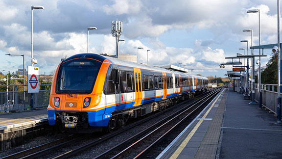
Suburban orbital rail network serving Greater London and Hertfordshire.
Connects outer districts not served by the Tube
Useful for east, north, and south London
Fully integrated with Oyster/contactless
Best for: Reaching neighborhoods like Hackney, Shoreditch, Clapham, Crystal Palace.
TfL formally named the Overground’s six lines to reflect London’s history:
- Lioness Line – Watford Junction ↔ Euston
- Mildmay Line – Stratford ↔ Richmond/Clapham Junction
- Windrush Line – Highbury & Islington ↔ West Croydon/Crystal Palace
- Weaver Line – Liverpool Street ↔ Cheshunt/Enfield Town/Chingford
- Suffragette Line – Gospel Oak ↔ Barking Riverside
- Liberty Line – Romford ↔ Upminster
These names help distinguish what used to be a confusing “all‑orange” network.
According to Metro Londres and TfL:
North & West London
Watford, Harrow, Willesden Junction, Euston
Richmond, Kew Gardens, Gunnersbury
Willesden ↔ Stratford orbital corridor
East London
Stratford, Hackney, Shoreditch High Street
Barking Riverside (new extension)
South London
Clapham Junction
West Croydon
Crystal Palace
The Overground is especially strong in Hackney, Shoreditch, Dalston, Camden, Croydon, and the Lea Valley.
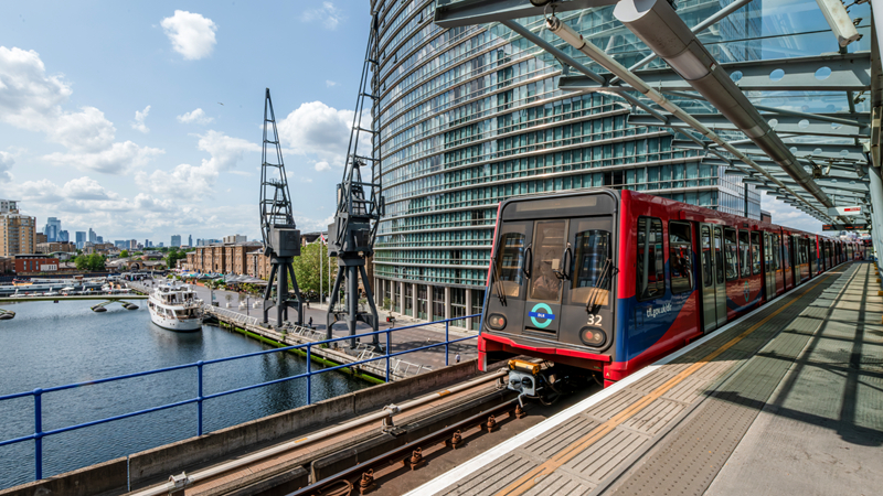
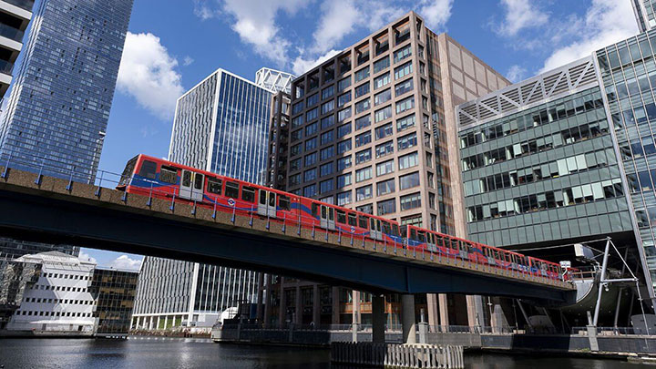
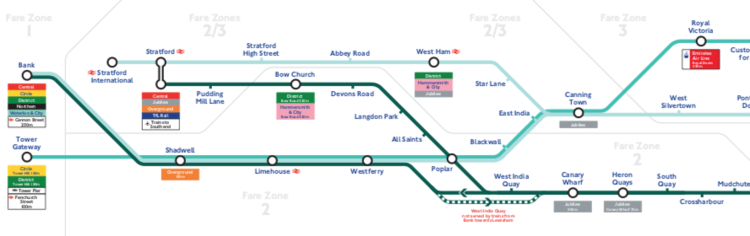
DLR (Docklands Light Railway)
The DLR is London’s fully driverless light‑metro system serving East and Southeast London, including Canary Wharf, Greenwich, Stratford, the Royal Docks, and London City Airport. It operates 45 stations across 38 km of track and is one of the most distinctive components of London’s transit ecosystem. Connects with the Tube at Bank, Tower Gateway, Stratford, Canary Wharf. Many sections run on viaducts, offering skyline views of Canary Wharf, the Thames, and the Royal Docks.
System length: 38 km (24 mi)
Top speed: 50 mph (80 km/h) capable; 40 mph (64 km/h) in regular service
Electrification: 750 V DC third rail
Train length: 2–3 cars per set
Headway: 3–5 minutes in core sections
The DLR operates 3 main service groups (with multiple branches):
Bank ↔ Lewisham
Stratford ↔ Canary Wharf / Lewisham / Woolwich Arsenal
Stratford International ↔ Beckton / Woolwich Arsenal
Key branches:
Beckton branch
Woolwich Arsenal branch
Lewisham branch
Stratford International branch
Major Destinations
Business & Finance
Canary Wharf
Heron Quays
Tourism & Culture
Greenwich (Cutty Sark, Maritime Museum)
Royal Docks
Excel Centre
Transport Hubs
Bank (Central/Northern lines)
Stratford (Central, Jubilee, Elizabeth line)
City Airport (LCY)
Airport Connections
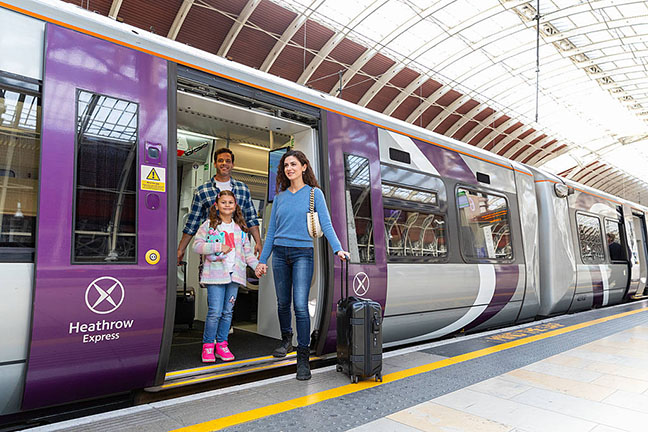
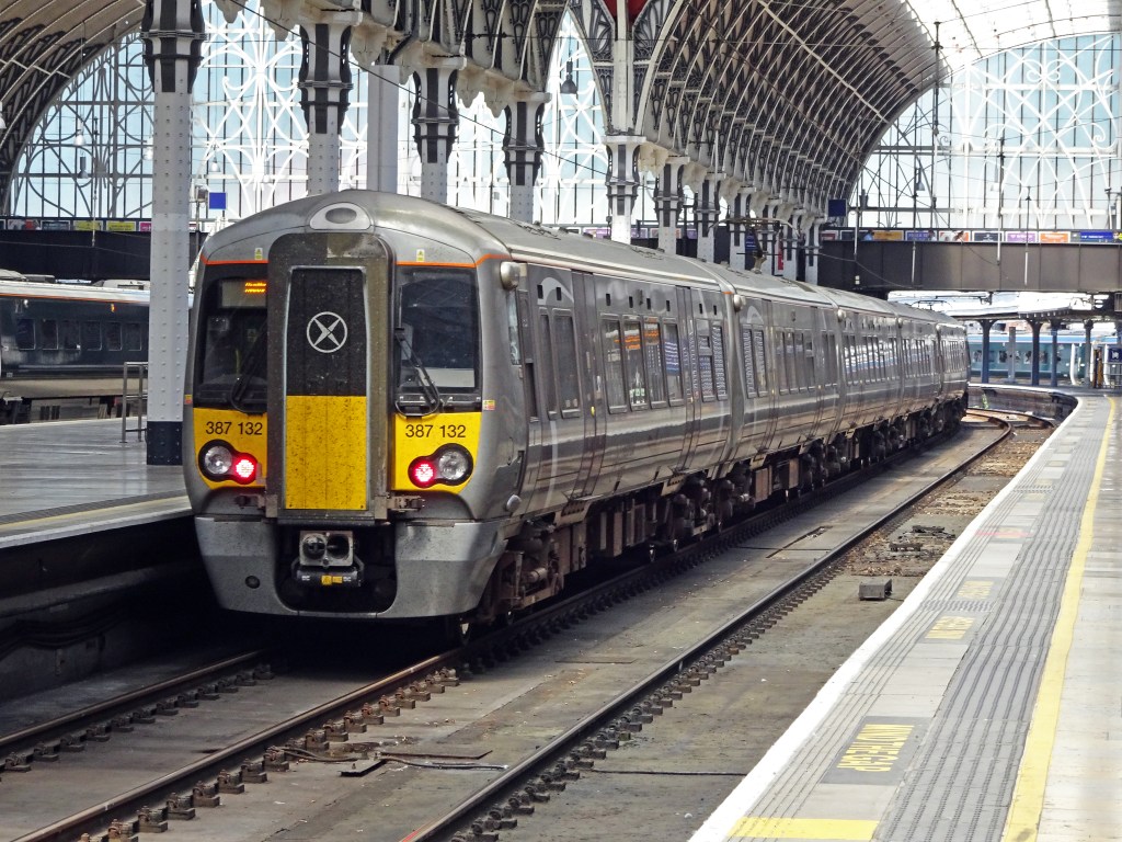
Heathrow Airport
Elizabeth line → Central London in ~28 minutes
Piccadilly line → Cheapest, ~50–60 minutes
Heathrow Express → Fastest to Paddington, 15 minutes (premium fare)
Gatwick Airport
London’s second‑largest airport.
Gatwick Express → Victoria
Thameslink → London Bridge, St Pancras
Southern → Victoria
London City Airport
Closest airport to central London.
DLR → Bank/Stratford + Canary Wharf
Scenic or Thematic Routes
Thames Clippers for skyline views
DLR front seat for a driverless Canary Wharf approach
Bus 9 for “Royal & Historic West London”
Bus 11 for a “budget sightseeing tour” (St Paul’s → Trafalgar → Westminster)
Bus 15 for “The Heritage Axis”
Embankment → Westminster walk for river + Parliament views
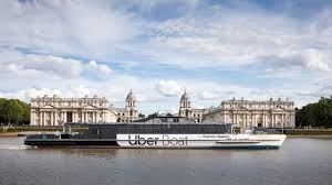
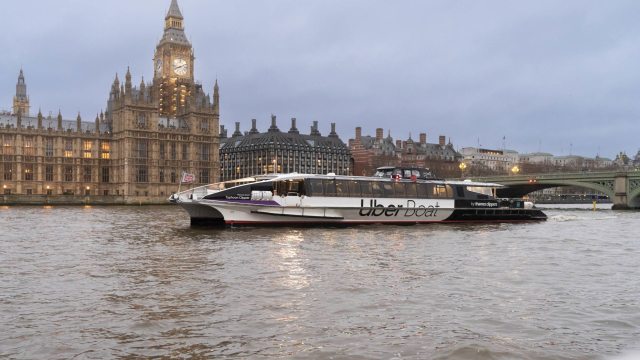
River Bus (Thames Clippers)
Thames Clippers is London’s official high‑speed river bus service, running commuter and sightseeing routes along the Thames with 24 piers, 23 vessels, and service from Putney to Barking Riverside. It’s one of the most scenic and comfortable ways to cross the city.
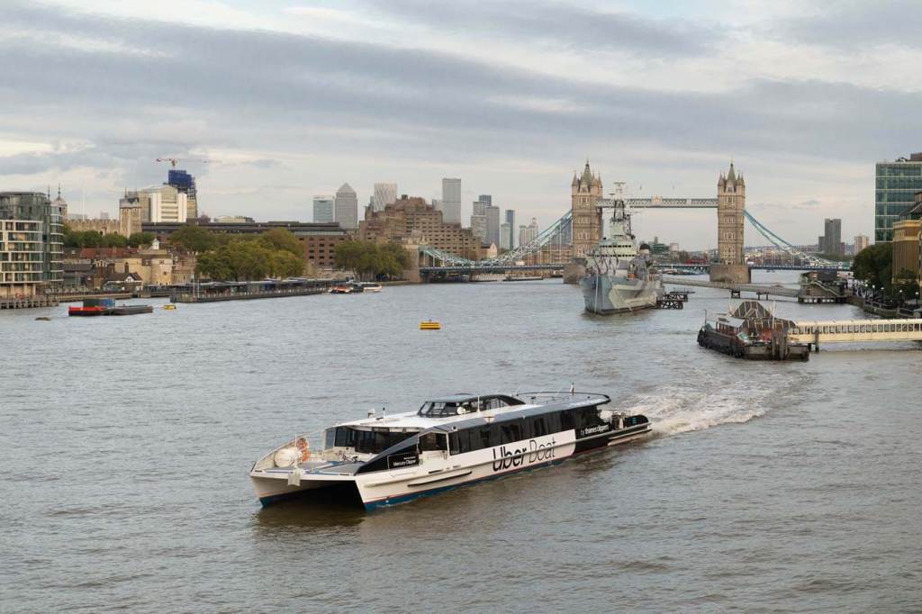
Fast, scenic commuter boats
Runs from Putney ↔ Canary Wharf ↔ Woolwich
Not part of standard TfL fare caps (separate pricing)
Average of 10,000 passengers daily
Best for: Scenic commuting, avoiding crowds, east–west travel along the Thames.
Key piers include:
Westminster
London Eye (Waterloo)
Embankment
Blackfriars
Bankside
London Bridge City
Tower
Greenwich
Canary Wharf
North Greenwich (The O2)
Woolwich
Barking Riverside
Why It’s Popular
Scenic Views
highlights the unparalleled views from the open deck and cabin seating.
Comfort
Onboard café bar with drinks and snacks
Indoor and outdoor seating
Smooth, quiet ride compared to buses or Tube
Flexibility
Hop‑on hop‑off options
Single, return, and all‑day passes available
Why Use Public Transit in London
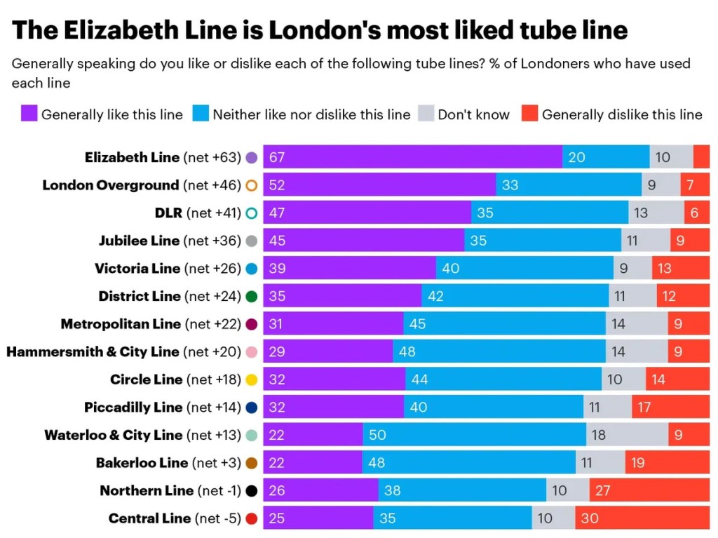
Using public transit in London is the fastest, cheapest, and most efficient way to move around the city, thanks to its dense multimodal network and modern payment systems. London’s transport system is widely regarded as one of the most comprehensive in the world, and buses alone deliver major social, economic, and environmental benefits for the city. UK-wide research shows public transport significantly reduces carbon emissions compared to private cars.
London’s contactless system is highlighted as a model for global cities. Owning and maintaining a car is expensive, while public transport is a more affordable alternative. London traffic is notoriously slow. ublic transit—especially the Tube, DLR, and Elizabeth line—avoids road congestion entirely.

Leave a comment